Image credit: M. Thoms
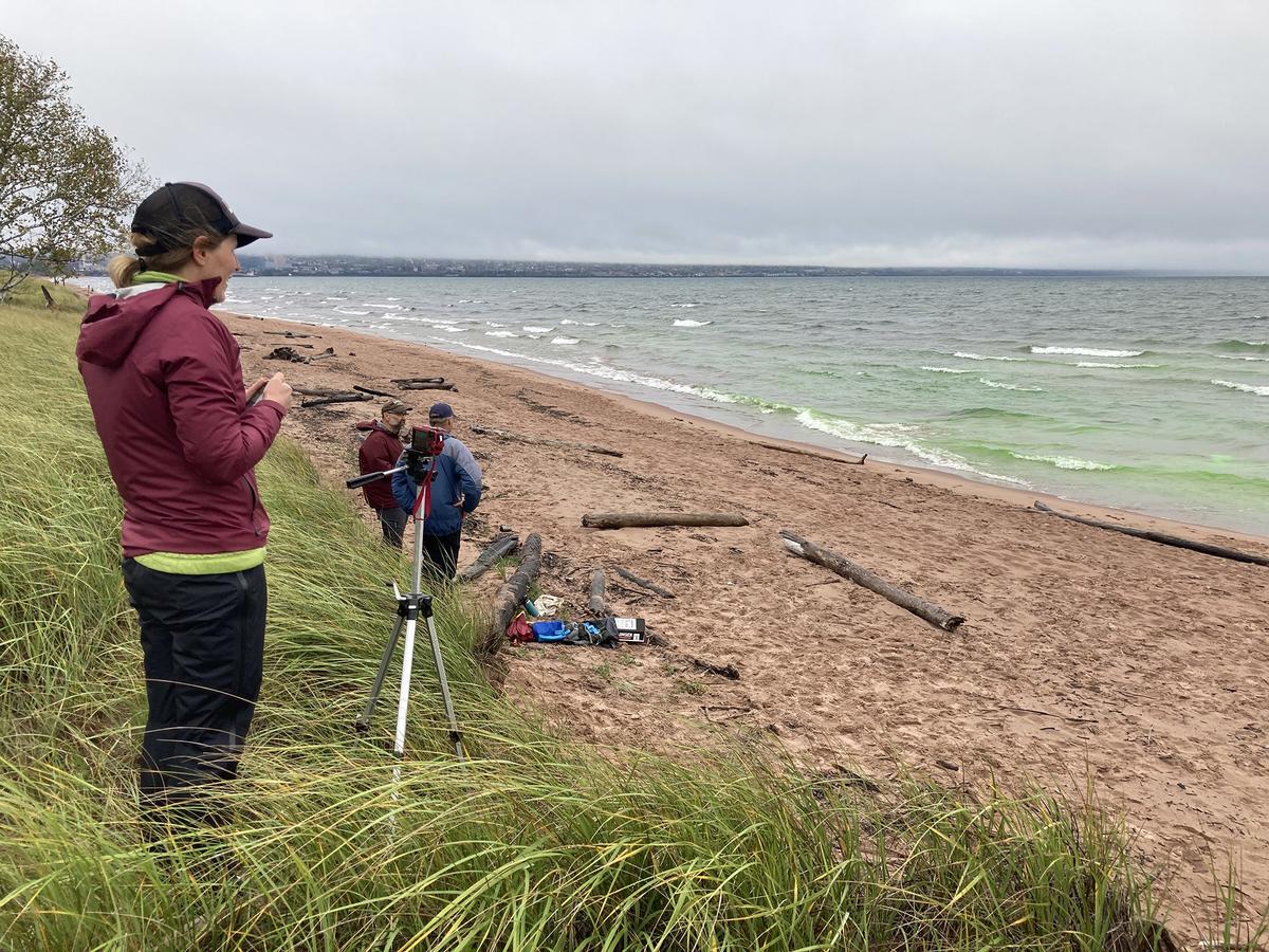
The goal of this project is to characterize and forecast dangerous currents - also called rip currents - on the south shore of Lake Superior (pictured above). This image, taken October 8, 2021, shows a food-grade green dye researchers used to visualize a rip current that was predicted or forecast for this spot on this day along Duluth's Park Point Beach.
Project description
Researchers and outreach professionals are collaborating to characterize and forecast dangerous currents on the south shore of Lake Superior. These currents have imperiled lives and drowned people.
The research team expects to improve dangerous current watches, warnings and advisories and to make these safety messages easily accessible to people who visit the Minnesota and Wisconsin coasts for recreation. The team is using remote sensing analysis, field measurements and cross-scale modeling to characterize dangerous currents and to better understand the mechanisms generating them.
The researchers are also developing an Integrated Nowcast-Forecast Operational System (INFOS) for dangerous currents in Lake Superior. This system, which integrates real-time water observations and a nearshore circulation model, will predict immediate (nowcast) and future (forecast) dangerous currents along the Minnesota and Wisconsin coasts. By 2020, the team expects that communities along Lake Superior’s south shore will be able to easily access and use the information on dangerous current watches, warnings and advisories generated through the collaboration.
Ultimately, the researchers hope the result of their efforts will save lives, foster coastal safety and encourage regional partnerships and resilience.
What have we done lately?

October 8, 2021. Research project members Jerry Henneck, senior research scientist, and Beth Bernhardt, aquatic scientist, both from the University of Minnesota Duluth Natural Resources Research Institute, were on Duluth's Park Point Beach from about 9:30 a.m. to 1:00 p.m. this day after being notified that conditions were right for the formation of a rip current at about 25th Street. Henneck chucked several "cupcakes" made of food-grade dye into the lake in hopes that as the dye dispersed it would help the researchers visualize the movement of water in a rip current. When their data has been processed, MNSG will update this project.
Partners and Collaborators
- Jerry Henneck, Senior Research Scientist, University of Minnesota Duluth, Natural Resources Research Institute, jhenneck@d.umn.edu
- Beth Bernhardt, Aquatic Scientist, University of Minnesota Duluth, Natural Resources Research Institute, bernh080@d.umn.edu
- National Oceanic and Atmospheric Administration's National Weather Service
- University of Minnesota Duluth
- University of Minnesota
- UMD Natural Resources Research Institute
- University of Wisconsin-Madison
- Wisconsin Coastal Management Program
- Great Lakes Environmental Research Laboratory
Funding
Minnesota Sea Grant provided research support through our 2018-2020 biennial competitive Request for Proposal (RFP) process. This project received an extension to June 2021 due to field work that was not completed during the summer of 2020.
Lead scientist(s)
Lian Shen, Professor
Department of Mechanical Engineering and Director of the St. Anthony Falls Laboratory
University of Minnesota Twin Cities
(612) 625-7527
shen@umn.edu
Wisconsin Co-PI:
Chin Wu, Professor
Department of Civil and Environmental Engineering
University of Wisconsin - Madison
(608) 263-3078
chinwu@engr.wisc.edu
Scholarly Articles
Hao, Xuanting and Shen, Lian (2022). A data-driven analysis of inhomogeneous wave field based on two-dimensional Hilbert–Huang transform. Wave Motion. https://doi.org/10.1016/j.wavemoti.2022.102896
Partners
- University of Wisconsin, Madison, Academic Institution (College and University)
- Wisconsin Department of Administration, Wisconsin Coastal Management Program, State/Local Government
- Wisconsin Sea Grant, Sea Grant Programs